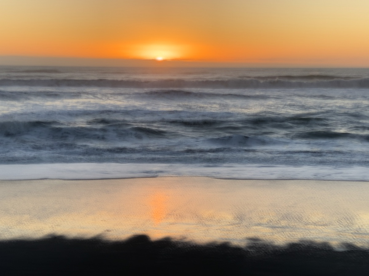
I have just been over to the West Coast for a couple of weekend trips. It is appealing to those of us living in Christchurch to experience the contrast between the two coasts. While Canterbury is dry, the West Coast is usually very wet. The sea is calm on our side, with plenty of swimming beaches. On the Coast, it is rough, often a boiling cauldron that deters anyone from approaching, let alone entering the surf. Even under deceptively calm conditions there are strong undertows, swirling currents and rogue waves that have caught many unawares.
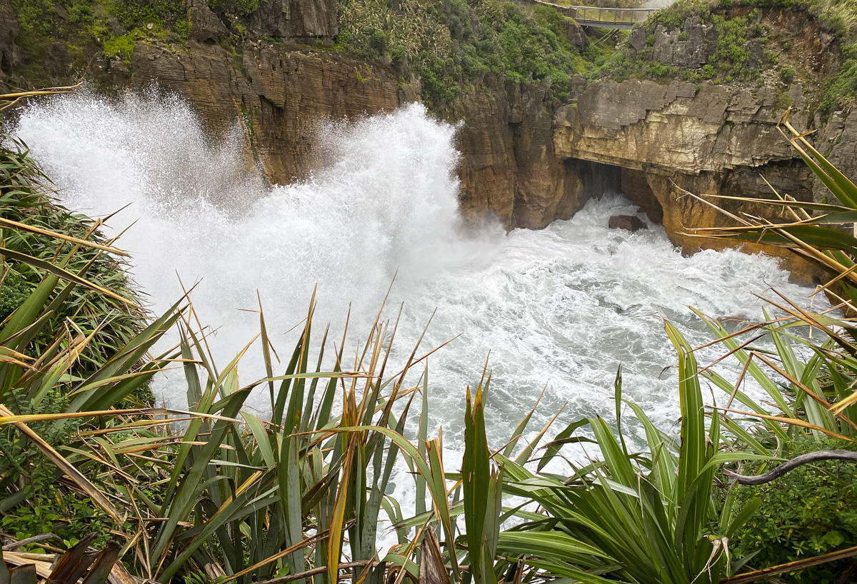
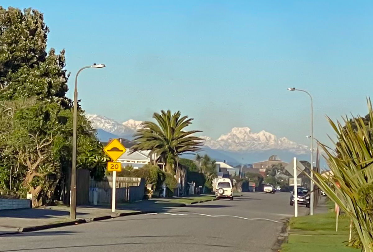
My two weekends were contrasting, too. Hokitika was so clear and sunny that New Zealand’s highest peaks, Mts Cook and Tasman, stood out from afar. The sky was overcast while were staying in Punakaiki, with the odd light shower of rain. It was pleasant enough to be outside photographing most of the time, though; nothing like the ferocious storm that battered the East Coast, wrecked bridges and roads, inundating farmland and urban areas alike while we were blissfully unaware of the devastation happening on the opposite coast. Christchurch generally receives 650 mm rain each year; this figure is 3000 mm on the West Coast. During the storm, touted as a one in a hundred year event, Christchurch received 150 mm in just 3 days, while in the hill country behind the city rainfall was more than 500 mm during the same period. The rain has now stopped, but rivers continue to run high and cleaning up and repair work has barely begun. I am still waiting to find out whether the roads will be open for my next trip out of town.
Recently a friend introduced me to a slow motion app for my phone, which I played while I was away, trying to discover what works and what doesn’t. This is still a work in progress, but here are two examples, the first from Hokitika, the second from Punakaiki.